Sequoia Deadman Canyon Trip 2003
I took this solo trip in early August 2003. Starting from Lodgepole this trip took me to Twin Lakes, over Silliman Pass, to Ranger Lakes, on to Comanche Meadow, past the Roaring River Ranger Station, through Deadman Canyon, over Elizabeth Pass, and along the High Sierra trail, past Bearpaw Meadow, and back to Crescent Meadow. It's 5o+ miles and easily do-able in a week. Though not quite a loop trip, getting from Crescent Meadow to Lodgepole is fairly easy - either hike it or bum a ride. Enjoy the pictures - I have some trip-related observations at the end.
I camped a little beyond this meadow. I had gotten a walk-in permit in the afternoon and needed to hike in enough to be "legal". It would also give me a chance to acclimatize overnight.

This is just before Silliman Pass. A pleasant place to bask in the sun before heading over the pass.


The forest fire visible near Comanche Meadow had me a little worried. However, it wasn't directly near the trail and I pressed on.

A nice spot to camp - no fish in the lake as far as I can tell.

After spending my third night near Sugarloaf meadow, I spent the fourth night at Roaring River. This is the halfway point with some very attractive campsites near the river.


Note that if you take the "Over the Hill" trail you'll miss this bridge - so take the trail down to the High Sierra trail instead of heading immediately to Bearpaw Meadow. You not only get to see the bridge but the flowers along the trail here are superb. You can also check out this bridge at the following Google Earth link (if you have it loaded on your computer). Make sure you have the "terrain" layer turned on !


There are developed campsites near here. The folks at the High Sierra camp are very nice - I mooched a delicious "brownie" off them !!
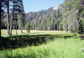
Cahoon Meadow

I camped a little beyond this meadow. I had gotten a walk-in permit in the afternoon and needed to hike in enough to be "legal". It would also give me a chance to acclimatize overnight.
Twin Lake
This is just before Silliman Pass. A pleasant place to bask in the sun before heading over the pass.
Views from Silliman Pass
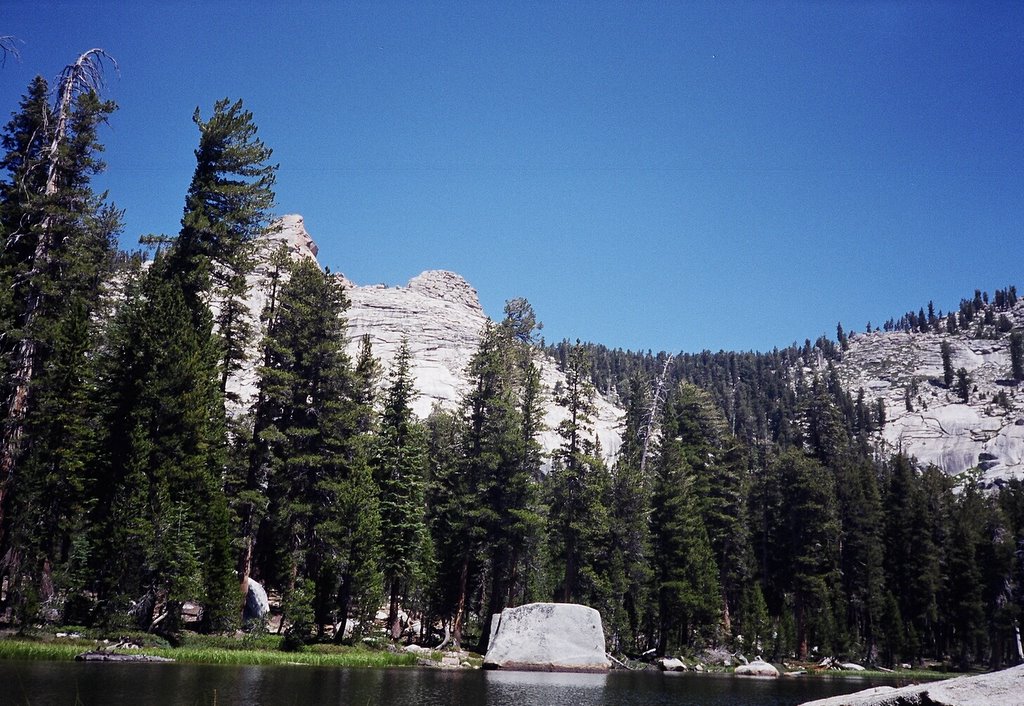
View of lake

Silliman Mountain

View of Comanche Meadow in the distance
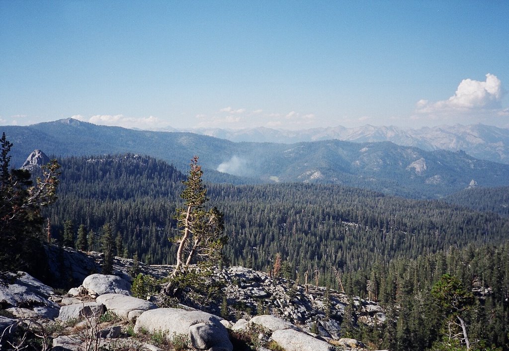
The forest fire visible near Comanche Meadow had me a little worried. However, it wasn't directly near the trail and I pressed on.
Ranger Lake

A nice spot to camp - no fish in the lake as far as I can tell.
On the way to Roaring River

Roaring River Ranger Station

After spending my third night near Sugarloaf meadow, I spent the fourth night at Roaring River. This is the halfway point with some very attractive campsites near the river.
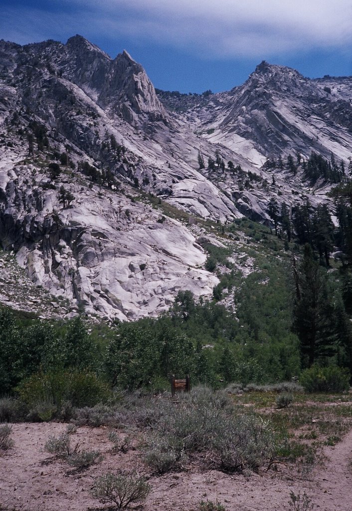
Deadman Canyon
This is truly a special place. Most of the time you have it to yourself. I camped that night at the head of the cirque - right over a bench overlooking the valley. In the canyon is the gravesite of a shepherd - hence the name of the canyon. Parts of the trail near the upper part of the canyon are overgrown with vegetation but there is no danger of getting lost.Trail to Deadman Canyon

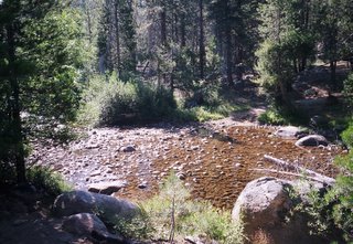
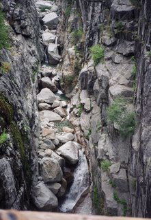
Stream in Deadman Canyon

Granite Formations

Shepherd's gravesite in Deadman Canyon
Closeup of gravesite

Stream cascading down granite in Deadman Canyon

Awesome granite spires

Ranger Meadow

Views of Elizabeth Pass in the distance

The perfect U-Shape carved by the glacier

Granite bench at the head of the cirque

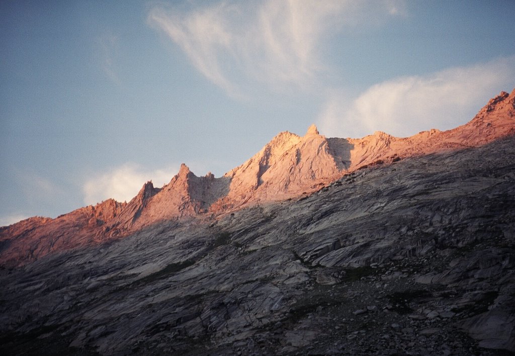
Alpenglow on the mountains at the head of the cirque
Coming up to the pass
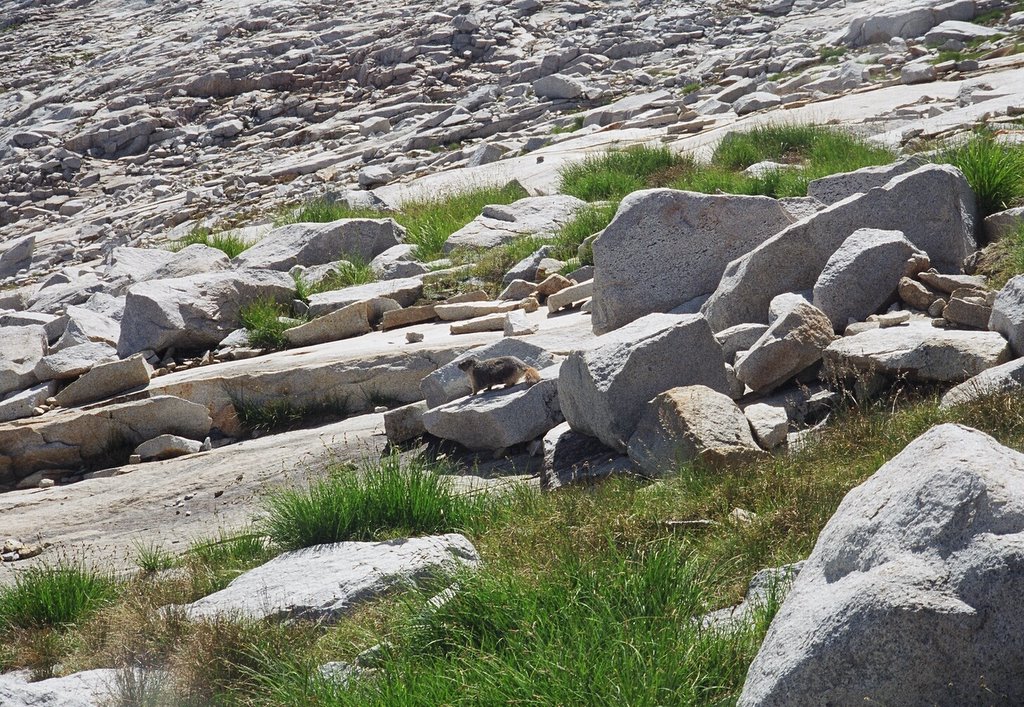
Marmot
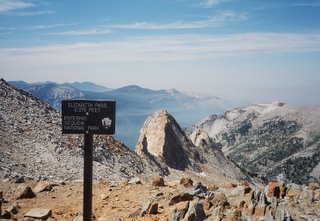
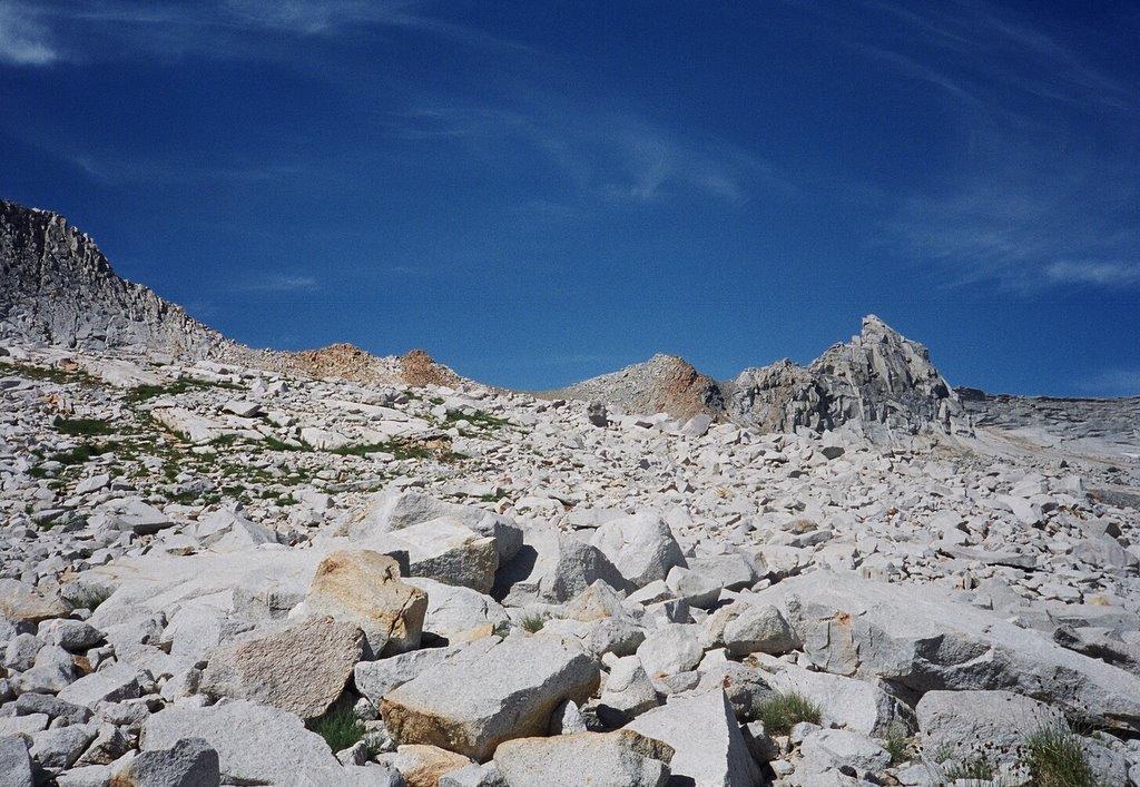
Elizabeth Pass

On to the High Sierra Trail
This section of the trail requires you to look for the next set of "ducks" to guide you. Once again the landscape is very open and easy to navigate.Rugged exfoliating granite near the pass

Views down into the Kaweah valley

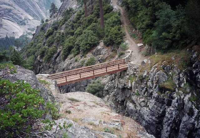
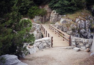
Bridge on the High Sierra trail over the outlet from Tamarack Lake

Note that if you take the "Over the Hill" trail you'll miss this bridge - so take the trail down to the High Sierra trail instead of heading immediately to Bearpaw Meadow. You not only get to see the bridge but the flowers along the trail here are superb. You can also check out this bridge at the following Google Earth link (if you have it loaded on your computer). Make sure you have the "terrain" layer turned on !

Looking down from the bridge

The High Sierra trail back to Crescent Meadow

High Sierra Camp on the High Sierra trail

There are developed campsites near here. The folks at the High Sierra camp are very nice - I mooched a delicious "brownie" off them !!
Misc Info
- Permits. I took a gamble in not making an advance reservation for the permit as I
figured I'd be able to get a walk-in permit. Luckily that was indeed the case and I was able to head out the same afternoon. - Safety. In addition to a detailed itinerary I left with both my wife and the ranger at Lodgepole, I also carried a satellite phone with me on this trip. I made one trial call with it and had excellent reception. I usually rent this for my solo trips.
- Food. A major mistake - it was going to be a week long trip so I had to carefully plan the packing of my bear canister. Unfortunately, I picked tortillas because of their "packing efficiency" even though I am not a big fan of them. By the third day I could barely put them in my mouth. All made worse by the fact that I deliberately did not take a stove to save weight.
- Pack. Gregory G-pack. Worked out great - especially compared to my older and much heavier pack.
- Shelter. A makeshift tarp that I put up with a single hiking pole with an emergency blanket for a ground sheet. This worked out fine too as I had excellent weather for the trip.
- Navigation. Topo maps and compass. GPS unit used to periodically confirm navigation.
posted by J. (Bob) Balaram at 9:02 PM
1 comments
![]()
![]()